© Use of content without authorization is prohibited

Aosta Valley
Aosta
VALLE D'AOSTA: Area: 3258.61 km² Population: 122,877 Municipalities: 74. In this small treasure chest of square kilometers lies a succession of valleys dominated by the highest mountains in Europe. Entering from Piedmont, the highway wedges itself between high ochre-colored rocks; and following a rushing river called Dora Baltea, you come across villages with characteristic roofs, and scattered on the slopes are fortresses and castles. I have visited every municipality in this beautiful region. Valdostan cuisine cannot do without Polenta Concia, a main dish often accompanied by mushrooms or sausage; Crespelle, and the indispensable homemade Black Bread. For desserts, without a doubt, Blanc Manger. To accompany the robust local cuisine, I prefer a red wine, and if you want to spend more than usual, an excellent glass of Le Cretes from Aymavilles. At the end of the meal, I recommend a herbal liqueur called Genepì.

Province of Aosta
Area: 3258.61 km² Population: 122,877 Municipalities: 74
travel stories...


Bionaz and the Place Moulin dam
La Magdeleine
Chamois
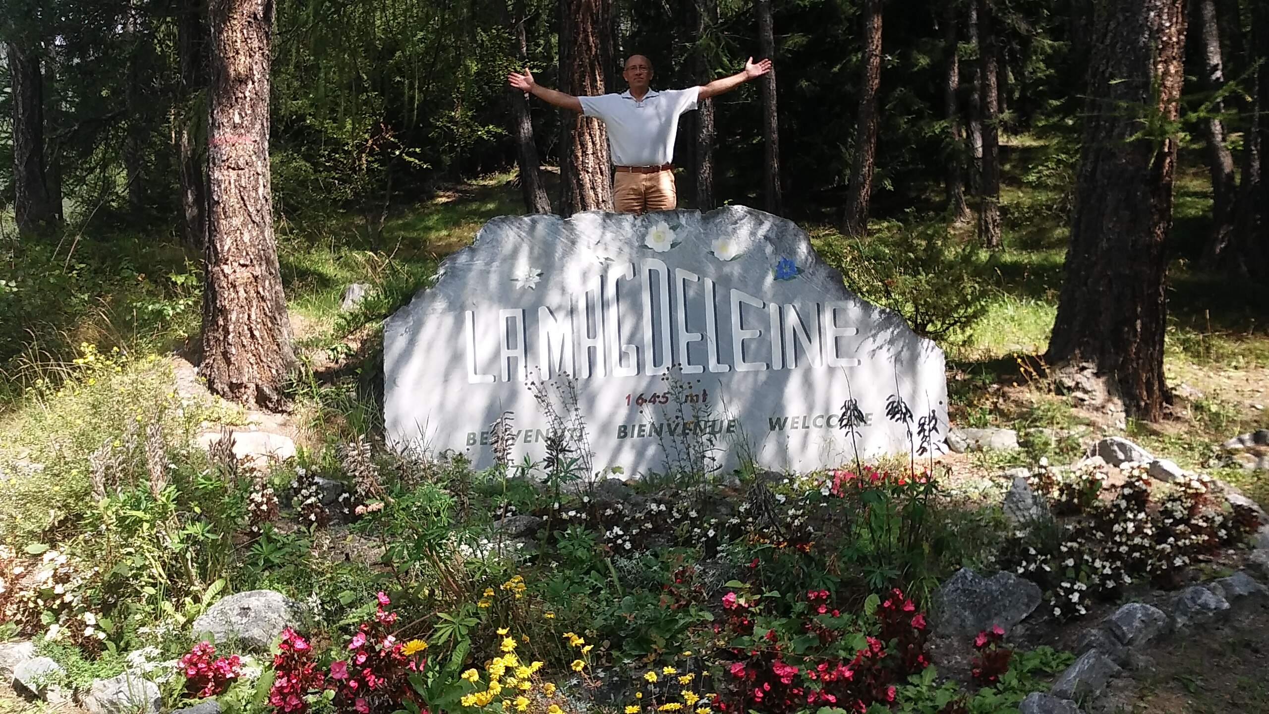
I often return to Valtournanche, where every village along the road to Cervinia is full of charm. When I arrived in the village of Audrey Sant’Andrè, I turned right to climb the road leading to the municipality of La Magdeleine. The area is very beautiful but the hairpin bends you have to tackle don't allow you to look around. At the entrance to the town there is a free underground parking lot where I left my car. From there, after a brief visit to the Parish Church, I walked through this village where the alternating houses and meadows with flowers of a thousand colors let you savor an atmosphere of peace. I went up to the hamlet of Vieu where I found a restaurant serving typical Valdostan cuisine. The outdoor table had a magnificent view of the snow-capped ridge of Monte Cervino. Here, in addition to a rich appetizer, I treated myself to a large pan of polenta concia and sausage, washed down with a good local wine. Now, ideally, a nap caressed by the gentle alpine breeze would be perfect, but I want to go for the walk that leads to Chamois; an adventure I had dreamed of for a long time, but that's another story.
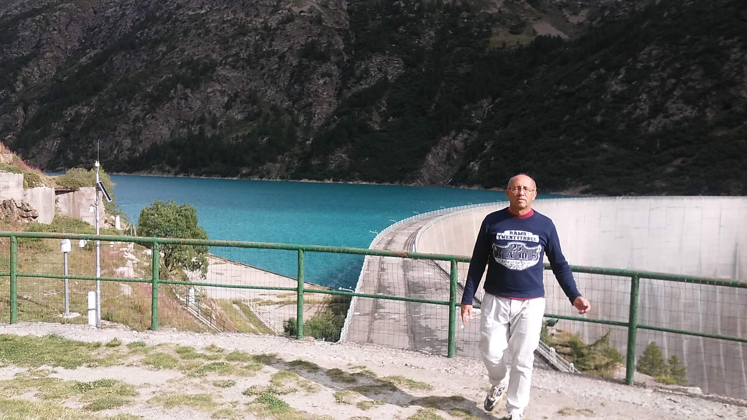
I crossed the entire Valpelline to reach the northernmost municipality of the Aosta Valley. A brief visit to the village of Bionaz Plan de Venye and then up towards Place Moulin. Climbing this road, I feel a strong emotion seeing this very high concrete wall behind which a lake of water is hidden, which gives life but could also bring destruction. I stop to take some photos: the images show a very cloudy sky, the mountains starting from snow-capped peaks, have brown rocks that, sloping southward, are covered with the dark green of fir trees; between the two sides, the dirty white wall of the mighty dam, and below, flowery meadows where the gray serpent of the state road winds. Once at the top, at the 1981 meters of Lake Place Moulin, I leave the car in the large parking lot; I put on my sweatshirt, and starting from the entrance of the dam, I walk for a kilometer along the artificial basin filled with water that, depending on the sunlight that occasionally peeks through the clouds, takes on the color of a pale blue or a pastel sky blue. From there, with travel times ranging from 1 to 4 hours, you can reach renowned alpine refuges. One, as a sign says, the Aosta Refuge, is located on the Tza de Tzan Glacier and is suitable only for experienced hikers.
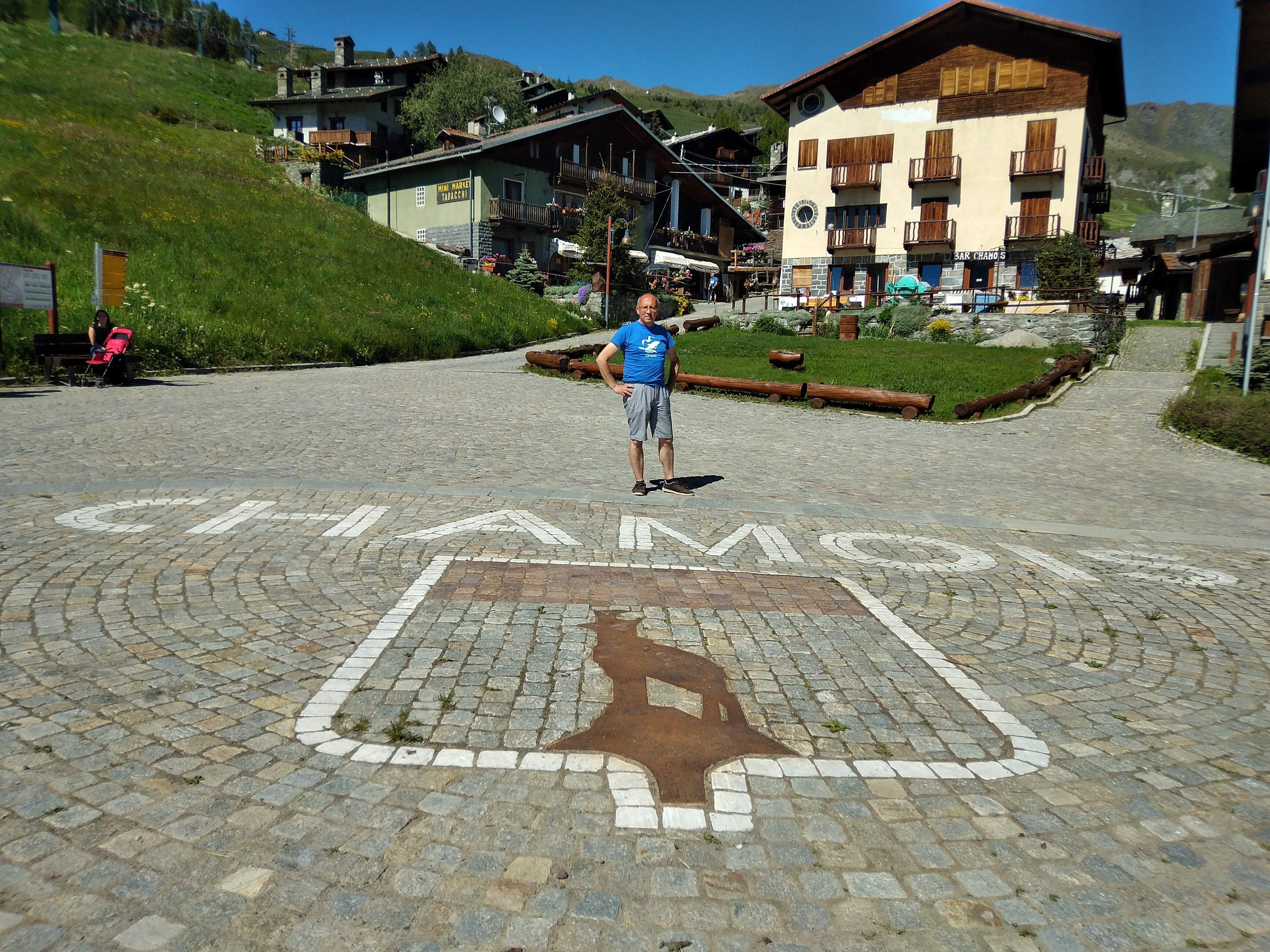
If you want to visit this alpine village, you can take the cable car, or, as I did, you have to earn it; because Chamois is the only municipality in Italy that cannot be reached by car. To get there by land, I walked for just over an hour on a gently uphill dirt path. Along the way, waterfalls, grazing cows, and beautiful views of Mount Cervino. At the entrance to the village, a bridge under which a stream plunges down a series of rapids into the valley. After a street that wedges between characteristic mountain houses, I arrive at the large square with the Town Hall and the Church on opposite sides. Ritual photo; this time the name of the village is written in white porphyry on the pavement, where the town's coat of arms also stands out. After seeing the arrival and departure of the cable car, I enter the Church to enjoy the peaceful atmosphere that reigns there; and also the cool shelter from the heat that on this early June day has reached even here at over 1800 meters above sea level. I pass in front of where the chairlift departs that leads to Lake Lod, which may be the goal of a future hike; for now, I fill my water bottle at one of the many fountains and start on my way back.
Travel photos...


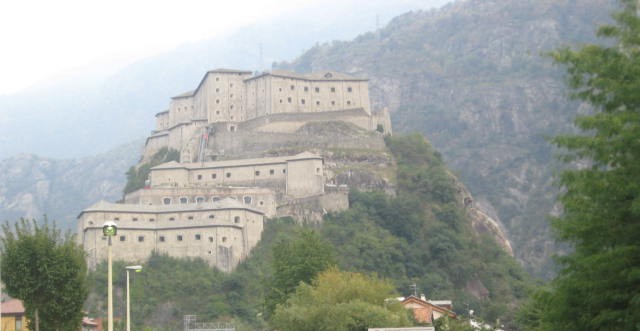
Fort of Bard
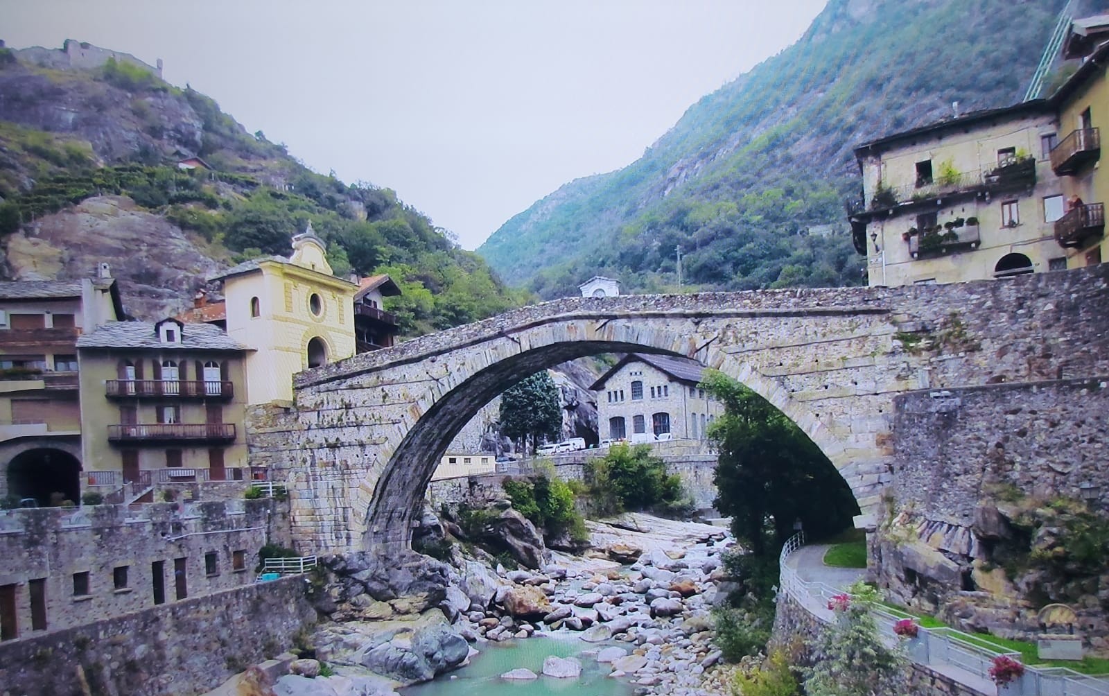
Pont Saint Martin
Fortress built by the House of Savoy in the 19th century
Medieval bridge
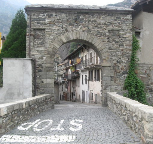
Donnaz
Entrance gate to the medieval village


Arvier
Arvier
La Thuile
In the background, the Castle of La Mothe
The Bell Tower of the Parish Church of San Sulpizio
Entrance to the village


Pre Saint Didier
Parish Church of San Lorenzo
Fenis
Place Moulin
Medieval Castle
Dam